


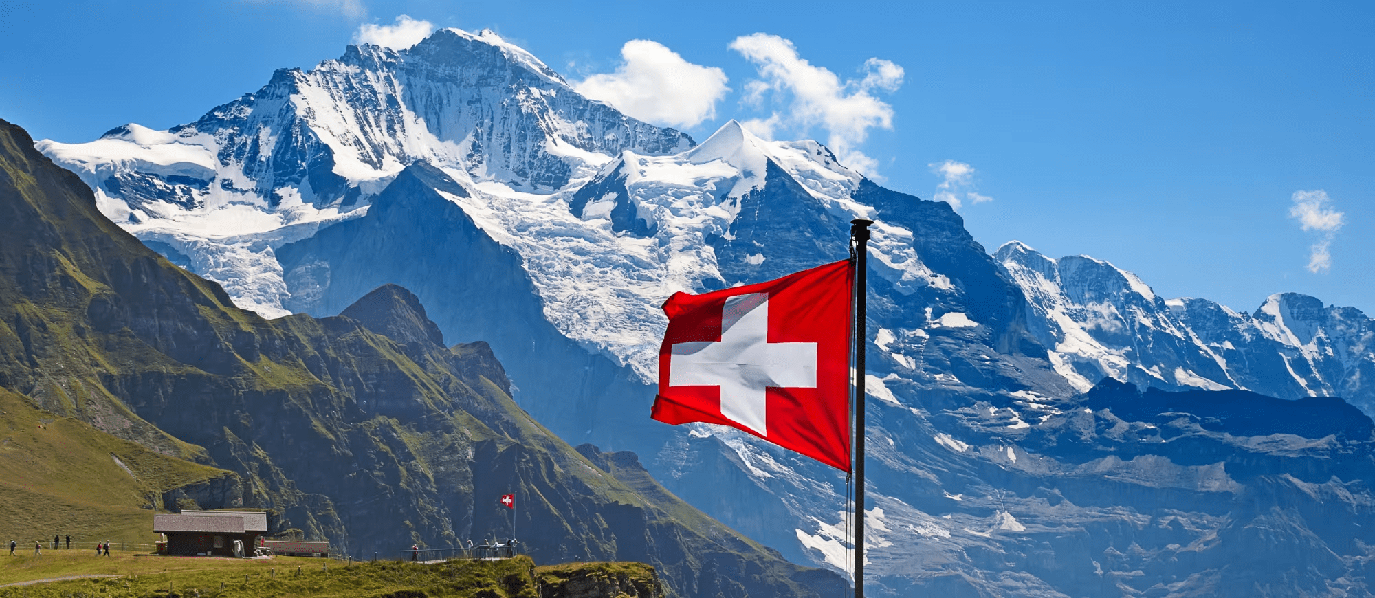
Nestled in the heart of Europe, Switzerland is a dream destination for hiking enthusiasts. This small country packs a punch with its stunning alpine landscapes, pristine lakes, charming villages, and an extensive network of well-maintained hiking trails.
Whether you’re a seasoned trekker or a casual walker, hiking in Switzerland offers something for everyone.
- 1. The Eiger Trail
- 2. Zermatt Five Lakes Walk
- 3. The Matterhorn Glacier Trail
- 4. Lauterbrunnen Valley Hike
- 5. Oeschinensee Panorama Hike
- 6. Schynige Platte to First
- 7. Creux du Van Hike
- 8. Hardergrat Trail
- 9. Aletsch Glacier Panorama Trail
- 10. Seealpsee Hike
- 11. Rigi Panorama Trail
- 12. Gemmi Pass Hike
- 13. Swiss Grand Canyon (Rhine Gorge) Hike
- 14. Männlichen to Kleine Scheidegg
- 15. Gornergrat to Riffelalp
- Best Seasons and Times for Hiking in Switzerland
- Essential Hiking Tips for Switzerland
- Why Choose OneVasco?
- FAQs
1. The Eiger Trail
This stunning trail runs along the base of the legendary Eiger North Face, offering incredible views of the Bernese Alps.
Difficulty: Moderate
Distance: ~6 km
Location: Grindelwald, Bernese Oberland
Cost: Free (Train ticket to Eigergletscher required)
Coordinates: 46°34’12.0″N 7°58’22.0″E
Key Tips:
-
Start from Eigergletscher Station and hike down to Alpiglen.
-
Ideal in summer when the wildflowers bloom.
-
Watch for rock climbers scaling the Eiger’s North Face.

2. Zermatt Five Lakes Walk
A picturesque hike featuring five stunning mountain lakes with reflections of the Matterhorn.
Difficulty: Easy to Moderate
Distance: ~9 km
Location: Zermatt, Valais
Cost: Free (Cable car to Blauherd recommended)
Coordinates: 46°00’45.0″N 7°44’52.0″E
Key Tips:
-
Best done from Blauherd to Sunnegga.
-
Ideal for families and casual hikers.
-
Take your camera for the Matterhorn reflections in the lakes.

3. The Matterhorn Glacier Trail
A breathtaking hike with glacier views, unique rock formations, and a close-up of the Matterhorn.
Difficulty: Moderate
Distance: ~7 km
Location:Zermatt, Valais
Cost: Free (Cable car to Schwarzsee recommended)
Coordinates: 45°58’10.0″N 7°39’51.0″E
Key Tips:
-
Start from Trockener Steg and end at Schwarzsee.
-
Best done in summer for glacier views.
-
Look out for Edelweiss flowers along the trail.
4. Lauterbrunnen Valley Hike
A peaceful valley hike featuring 72 waterfalls, green meadows, and traditional Swiss chalets.
Difficulty: Easy
Distance: ~10 km
Location: Lauterbrunnen, Bernese Oberland
Cost: Free
Coordinates: 46°35’35.0″N 7°54’19.0″E
Key Tips:
-
Walk from Lauterbrunnen to Stechelberg.
-
Visit the Trümmelbach Falls, a series of waterfalls inside the mountain.
-
Perfect for families and photographers.
5. Oeschinensee Panorama Hike
A stunning hike with crystal-clear lake views and dramatic cliffs.
Difficulty: Moderate
Distance: ~8 km
Location: Kandersteg, Bernese Oberland
Cost: Free (Gondola to Oeschinen recommended)
Coordinates: 46°30’45.0″N 7°43’50.0″E
Key Tips:
-
Visit in summer for the best lake reflections.
-
Great for swimming and picnicking after the hike.
-
Follow the ridge trail for the best views.
6. Schynige Platte to First
A classic alpine hike with breathtaking views of the Eiger, Mönch, and Jungfrau.
Difficulty: Challenging
Distance: ~16 km
Location: Interlaken, Bernese Oberland
Cost: A train ticket is required for Schynige Platte
Coordinates: 46°39’31.0″N 7°54’44.0″E
Key Tips:
-
Take the Schynige Platte railway for a scenic start.
-
Enjoy panoramic views of Lake Brienz.
-
Best done on clear days for mountain views.
7. Creux du Van Hike
A spectacular natural rock amphitheater in the Jura Mountains.
Difficulty: Moderate
Distance: ~14 km
Location: Neuchâtel
Cost: Free
Coordinates: 46°54’30.0″N 6°43’00.0″E
Key Tips:
-
Perfect for wildlife spotting, including ibex.
-
Start early to avoid crowds.
-
A great hike in autumn for fall colors.
8. Hardergrat Trail
One of the most dangerous yet rewarding ridge hikes in Switzerland.
Difficulty: Very Challenging
Distance: ~24 km
Location: Interlaken, Bernese Oberland
Cost: A train ticket for Harder Kulm recommended
Coordinates: 46°41’19.0″N 7°52’26.0″E
Key Tips:
-
Only for experienced hikers with no fear of heights.
-
Bring enough water, as there are no refill points.
-
Avoid during bad weather for safety reasons.
9. Aletsch Glacier Panorama Trail
A breathtaking hike along the largest glacier in the Alps, offering stunning ice and mountain views.
Difficulty: Moderate
Distance: ~12 km
Location: Valais
Cost: Free (Cable car to Bettmerhorn recommended)
Coordinates: 46°23’50.0″N 8°04’05.0″E
Key Tips:
-
Best done in summer and early autumn when the trail is snow-free.
-
Stop at Bettmerhorn Viewpoint for the best glacier views.
-
Wear layers as the temperatures can change quickly.
10. Seealpsee Hike
A short yet stunning hike leading to a picturesque alpine lake surrounded by rugged cliffs.
Difficulty: Easy to Moderate
Distance: ~4 km
Location: Appenzell Alps
Cost: Free
Coordinates: 47°16’34.0″N 9°24’19.0″E
Key Tips:
-
Great for families and casual hikers.
-
Visit in the early morning for the best lake reflections.
-
Try Swiss Rösti at the lakeside restaurant.
11. Rigi Panorama Trail
A beautiful ridge hike with 360-degree views of Lake Lucerne and the surrounding mountains.
Difficulty: Easy to Moderate
Distance: ~7 km
Location:Central Switzerland
Cost: Free (Train ticket to Rigi Kulm recommended)
Coordinates: 47°03’16.0″N 8°28’54.0″E
Key Tips:
-
Take the Rigi Kulm cogwheel train for a scenic ride.
-
Visit in spring or autumn for clear views and fewer crowds.
-
Perfect for a relaxed day trip from Lucerne.
12. Gemmi Pass Hike
A historic trail used by traders for centuries, featuring cliffs and panoramic views.
Difficulty: Moderate
Distance: ~9 km
Location: Valais
Cost: Free (Cable car to Sunnbüel recommended)
Coordinates: 46°23’06.0″N 7°37’40.0″E
Key Tips:
-
Start from Sunnbüel and hike to Leukerbad.
-
Look out for ibex and other alpine wildlife.
-
Best done in late summer or early autumn.
13. Swiss Grand Canyon (Rhine Gorge) Hike
A dramatic gorge hike through Switzerland’s answer to the Grand Canyon, with unique rock formations and river views.
Difficulty: Easy to Moderate
Distance: ~13 km
Location: Graubünden
Cost: Free
Coordinates: 46°47’25.0″N 9°19’10.0″E
Key Tips:
-
Take a boat ride along the Rhine for a different perspective.
-
Best done in autumn when the leaves change color.
-
A great option for photographers and nature lovers.
14. Männlichen to Kleine Scheidegg
A scenic ridge hike with some of the best views of the Eiger, Mönch, and Jungfrau.
Difficulty: Easy
Distance: ~5 km
Location: Bernese Oberland
Cost: Free (Cable car to Männlichen recommended)
Coordinates: 46°36’00.0″N 7°56’38.0″E
Key Tips:
-
Perfect for a relaxed half-day hike.
-
Visit in summer for green meadows filled with wildflowers.
-
Stop at Kleine Scheidegg station for local Swiss food.
15. Gornergrat to Riffelalp
A high-altitude hike with stunning Matterhorn views and glacial landscapes.
Difficulty: Moderate
Distance: ~6 km
Location: Zermatt, Valais
Cost: Free (Train ticket to Gornergrat recommended)
Coordinates: 45°59’38.0″N 7°47’45.0″E
Key Tips:
-
Take the Gornergrat Railway for an unforgettable ride.
-
Best done in summer or autumn for clear views.
-
Enjoy the alpine scenery and glacier lookouts.
Best Seasons and Times for Hiking in Switzerland
-
Spring (April – June): Ideal for valley hikes with blooming flowers.
-
Summer (July – September): Perfect for high-altitude hikes with clear skies.
-
Autumn (October – November): Best for fall foliage and fewer crowds.
-
Winter (December – March): Best for snowshoe hiking and lower-elevation trails.
Essential Hiking Tips for Switzerland
-
Check the weather forecast before heading out.
-
Wear proper hiking shoes for uneven terrain.
-
Carry enough water and snacks, especially for long hikes.
-
Respect nature by following the “Leave No Trace” principles.
-
Use the Swiss public transport system to access remote trails.
-
Start early to enjoy the best views and avoid crowds.
Why Choose OneVasco?
OneVasco makes visa applications effortless. Our expert team manages the entire process, allowing you to focus on your journey. Enjoy stress-free travel with fast visa approvals.
-
Expert and Personalized Support
-
Efficient and Hassle-Free Process
-
Real-Time Tracking and Updates
-
Transparent Communication
-
Trusted by Millions
FAQs
1. Do I need to be an experienced hiker to enjoy hiking in Switzerland?
No, Switzerland offers hiking trails for all skill levels, from easy walks to challenging multi-day treks. Many trails are well-marked and maintained, making them accessible to novice hikers.
2. What should I pack for a day hike in Switzerland?
Essential items include sturdy hiking boots, plenty of water, snacks, sunscreen, a hat, sunglasses, a map or GPS device, and a lightweight rain jacket. Depending on the weather and the trail, you may also want to bring layers, hiking poles, and a first-aid kit.
3. Do I need a guide for hiking in Switzerland?
While a guide is not necessary for most hikes in Switzerland, it can be helpful for more challenging or remote trails. A guide can provide local knowledge, ensure your safety, and help you navigate any tricky sections.
4. Are there any free hiking trails in Switzerland?
Yes, there are many free hiking trails in Switzerland, especially in the valleys and around the lakes. Some popular free trails include the Lavaux Vineyard Terraces, the Aletsch Glacier Trail, and the Grindelwald-First Trail.
5. What is the best time of year to go hiking in Switzerland?
The best time for hiking in Switzerland is from July to September when most trails are open and the weather is generally stable. However, fall can also be a great time to hike, with mild temperatures and stunning foliage.
6. Are there any hiking trails suitable for families with children?
Yes, Switzerland offers many family-friendly hiking trails, especially around the lakes and in the valleys. Some popular options include the Matterhorn Trail in Zermatt, the Oeschinensee Lake Trail in Kandersteg, and the Creux du Van Trail in the Jura Mountains.
7. How do I get to the hiking trails in Switzerland?
Switzerland has an extensive public transportation system, including trains, buses, and cable cars. Many hiking trails are accessible by public transport, making it easy to get to the trailhead without a car. Some popular hiking areas, like Zermatt and Wengen, are car-free and can only be accessed by train or cable car.
8. Do I need to worry about altitude sickness when hiking in Switzerland?
Altitude sickness can be a concern when hiking at high elevations, especially above 2,500 meters (8,200 feet). Symptoms include headache, nausea, fatigue, and dizziness.
9. Are there any famous long-distance hiking trails in Switzerland?
Yes, Switzerland is home to several famous long-distance hiking trails, including:
-
Via Alpina: A long-distance trail that crosses eight Alpine countries, including Switzerland.
-
Haute Route: A challenging 12-day trek from Chamonix, France to Zermatt, Switzerland.
-
Alpine Pass Route: A 20-day trek that crosses 16 mountain passes in the Swiss Alps.


