


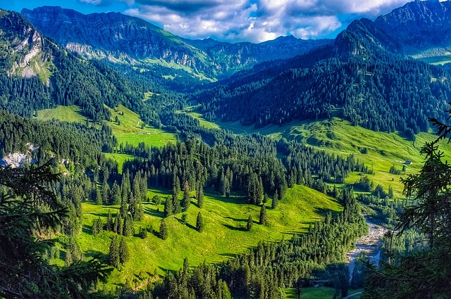
The Austrian Alps rise from lush valleys in dramatic walls of limestone and granite. Trails crisscross this alpine wonderland, connecting charming mountain huts, crystal-clear lakes, and flower-filled meadows.
Hiking in Austria offers experiences for every skill level. You can enjoy gentle valley strolls or take on challenging multi-day treks. Some routes cross exposed ridges and glacier fields.
Austria has over 50,000 km of marked paths. This makes it a paradise for outdoor enthusiasts from around the world, including growing numbers of Indian tourists seeking alpine adventures.
10 Best Hiking Places in Austria
- 1. Adlerweg (Eagle Walk)
- 2. Stubai High Trail (Stubaier Höhenweg)
- 3. Emperor’s Crown Trail (Kaiserkrone)
- 4. Salzburger Almenweg
- 5. Lynx Trail (Luchs Trail)
- 6. Lech River Trail (Lechweg)
- 7. Lammerklamm Gorge Trail
- 8. Rax Plateau Trails
- 9. Gesäuse National Park Trails
- 10. Dachstein Glacier Trail
- Why Choose OneVasco?
- FAQs
1. Adlerweg (Eagle Walk)
The Adlerweg, meaning “Eagle’s Path,” is Austria’s signature long-distance hiking trail. It stretches across the Tyrolean Alps in the shape of an eagle with outstretched wings.
The trail offers a mixture of terrain types from gentle forest paths to exposed mountain ridges, making it suitable for a range of abilities.
-
Difficulty: Moderate to difficult; some sections have exposed ridges with steel cable supports, but no technical climbing skills required
-
Distance: 413 km total, divided into 33 manageable stages
-
Location: Tyrol, starting in St. Johann and ending near St. Christoph am Arlberg
-
Cost: Trail access is free; mountain huts cost €30-€60 per night (approximately ₹2,700-₹5,400); cable cars (if used) cost extra
-
Great for: Experienced hikers, multi-day trekkers, small groups seeking a challenge
-
Coordinates: St. Johann (47.5231° N, 12.8006° E) to St. Christoph (47.1333° N, 10.2167° E)
-
Key Tips:
-
Book huts in advance during July-August
-
Carry cash, as many huts don’t accept cards
-
The trail is broken into stages, so you can tackle just a section rather than the entire route
-
Suggested Read: Austria Visa for Indians
2. Stubai High Trail (Stubaier Höhenweg)

The Stubai High Trail ranks among the most challenging and famous hiking spots in Austria. This high-altitude route traverses the Stubai Alps with dramatic views of glaciers, peaks, and valleys. It requires good fitness and comfort with height exposure.
-
Difficulty: Difficult (classified as a black trail); requires sure-footedness and a head for heights
-
Distance: 80 km, typically completed in 7 stages
-
Location: Stubai Valley, Tyrol, starting and ending in Neustift im Stubaital
-
Cost: Trail access is free; mountain huts €30-€60 per night (₹2,700-₹5,400)
-
Great for: Experienced alpine hikers, adventure seekers, photographers
-
Coordinates: Neustift im Stubaital (47.1106° N, 11.3125° E)
-
Key Tips:
-
Avoid during bad weather
-
Book huts months in advance
-
Some exposed sections have steel cables for safety
-
Bring hiking poles and proper mountain boots
-
Suggested Read: Austria Visa Extension for Indians
3. Emperor’s Crown Trail (Kaiserkrone)
The Kaiserkrone circles the impressive Wilder Kaiser massif, a dramatic limestone mountain range with jagged peaks. This trail offers a good balance of challenge and accessibility, making it one of the best hiking trails in Austria for intermediate hikers.
-
Difficulty: Moderate; mostly red-marked trail with some steep sections
-
Distance: 65 km, typically divided into 5-7 stages
-
Location: Wilder Kaiser region, Tyrol
-
Cost: Free hiking trails in Austria like this one have no access fee; mountain huts cost €30-€60 per night (₹2,700-₹5,400)
-
Great for: Intermediate hikers, couples looking for a multi-day adventure, small groups
-
Coordinates: Ellmau (47.5131° N, 12.3028° E)
-
Key Tips:
-
The Trail can be shortened by using cable cars or buses between sections
-
The summer season (June-September) offers the most reliable weather
-
The views of limestone cliffs are most dramatic in morning light
-
4. Salzburger Almenweg

The Salzburger Almenweg connects over 120 traditional alpine pasture huts across the meadows of Salzburg’s Pongau region. It’s known for gentle gradients and beautiful scenery, making it accessible to less experienced hikers.
-
Difficulty: Easy to moderate; mostly red-marked trails with gradual ascents
-
Distance: 350 km, divided into 31 stages
-
Location: Salzburg State, Pongau region
-
Cost: These are free hiking trails in Austria; mountain huts €25-€50 per night (₹2,250-₹4,500)
-
Great for: Families, beginners, food lovers (alpine dairy products), group hiking in Austria
-
Coordinates: St. Johann im Pongau (47.3500° N, 13.2000° E)
-
Key Tips:
-
Try local dairy specialties at the huts
-
The route is flexible with public transport options if you want to skip sections
-
Dogs are welcome on many sections
-
Suggested Read: Austria Visa Appeal For Indians
5. Lynx Trail (Luchs Trail)
The Luchs Trail is a nature-focused route crossing through three protected wilderness areas, including the last remnants of Austria’s primeval forests. Named after the rare European lynx that inhabits these forests, the trail emphasizes wildlife and pristine nature.
-
Difficulty: Moderate; well-marked paths through forests and hills
-
Distance: 210 km, divided into 11 stages
-
Location: Connects Kalkalpen National Park, Gesäuse National Park, and Dürrenstein Wilderness Area
-
Cost: Trail access is free; accommodations along route €25-€60 per night (₹2,250-₹5,400)
-
Great for: Nature enthusiasts, wildlife watchers, forest lovers, couples
-
Coordinates: Reichraming (47.8478° N, 14.4181° E) is a good starting point
-
Key Tips:
-
Bring binoculars for wildlife spotting
-
Walk quietly for better chances of seeing animals
-
Visit the Wilderness Museum in Lunz am See for information about local ecosystems
-
Suggested Read: Austria Visa Photo Size Requirement & Specification Guide
6. Lech River Trail (Lechweg)

The Lechweg follows the turquoise Lech River from its source in Vorarlberg to Füssen in Germany. This trail takes hikers through alpine meadows, forests, and charming villages, with mostly gentle terrain.
-
Difficulty: Easy to moderate; suitable for most fitness levels
-
Distance: 125 km total
-
Location: Vorarlberg and Tyrol, starting at Lech am Arlberg
-
Cost: Free access; accommodations in towns along the route €30-€60 per night (₹2,700-₹5,400)
-
Great for: Beginners, families, river lovers, couples
-
Coordinates: Lech am Arlberg (47.2102° N, 10.1418° E)
-
Key Tips:
-
Don’t miss the Holzgau suspension bridge (200m long, 110m high)
-
Good public transportation allows for flexibility
-
Ideal for self-guided hiking with excellent signage
-
Suggested Read: How to Book an Austria Visa Appointment?
7. Lammerklamm Gorge Trail
The Lammerklamm Gorge provides a dramatic short hike through a narrow canyon carved by the Lammer River. Wooden walkways and bridges allow hikers to experience the power of water up close.
-
Difficulty: Easy; suitable for all fitness levels
-
Distance: 2-3 km (round trip)
-
Location: Near Hallein, Salzburg region
-
Cost: Entry fee applies (approximately €6-€8 or ₹540-₹720)
-
Great for: Families, photographers, those seeking a quick nature experience, couples
-
Coordinates: 47.5781° N, 13.2847° E
-
Key Tips:
-
Visit in spring when snowmelt increases water flow
-
Bring a waterproof camera
-
Wear sturdy shoes as walkways can be slippery
-
Suggested Read: How to Check Austria Visa Status in India
8. Rax Plateau Trails

The Rax Plateau offers a network of relatively easy trails on a high limestone plateau, accessible by cable car. It’s popular with Viennese day-trippers due to its proximity to the capital.
-
Difficulty: Easy to moderate; well-marked paths on the plateau
-
Distance: Various routes from 5-20 km
-
Location: Rax Alps, Lower Austria/Styria border
-
Cost: Trail access is free; cable car ticket costs €30-€40 (₹2,700-₹3,600) round trip
-
Great for: Day hikers, families, beginners, groups
-
Coordinates: 47.7083° N, 15.7667° E
-
Key Tips:
-
Check the cable car operating hours
-
Hike to the Ottohaus for traditional Austrian food
-
The plateau can be windy, so bring a jacket even in summer
-
Suggested Read: Reasons for Austria Visa Rejection for Indian Nationals
9. Gesäuse National Park Trails

Gesäuse National Park features dramatic limestone peaks and pristine alpine rivers. The park offers a range of trails from easy valley walks to demanding summit ascents, making it one of the best hiking trails in Austria for nature lovers.
-
Difficulty: Easy to difficult; trails for all levels
-
Distance: Various routes from 6-25 km
-
Location: Styria, Northern Limestone Alps
-
Cost: Park access is free; guided tours are available for a fee
-
Great for: Nature enthusiasts, photographers, wilderness seekers, all ability levels
-
Coordinates: 47.6000° N, 14.6167° E (park center)
-
Key Tips:
-
Visit the Weidendom visitor center for trail information
-
The Hochtor and Buchstein peaks offer challenging routes for experienced hikers
-
Watch for wildlife, including chamois and golden eagles
-
10. Dachstein Glacier Trail

The Dachstein Glacier offers a unique opportunity to hike across one of Austria’s most accessible glaciers. The trail includes dramatic views and the famous “Skywalk” viewing platform.
-
Difficulty: Moderate; some sections with height exposure
-
Distance: 8-12 km, depending on route choice
-
Location: Dachstein massif, Upper Austria/Styria border
-
Cost: Glacier cable car ticket €40-€50 (₹3,600-₹4,500); trail access free once on the mountain
-
Great for: Glacier enthusiasts, photographers, adventure seekers
-
Coordinates: 47.4833° N, 13.6000° E
-
Key Tips:
-
Bring sun protection—glacier reflection intensifies UV rays
-
Dress in layers as temperatures can be 10-15°C cooler than in the valley
-
Suggested Read: Top Austria Famous Foods You Must Try at Least Once
Why Choose OneVasco?
OneVasco makes visa applications effortless. Our expert team manages the entire process, allowing you to focus on your journey.
Enjoy stress-free travel with fast visa approvals.
-
Expert and Personalized Support
-
Efficient and Hassle-Free Process
-
Real-Time Tracking and Updates
-
Transparent Communication
-
Trusted by Millions
FAQs
What are the different types of hiking trails in Austria?
Austria uses a color-coding system for trails. Blue is easy and flat. Red is moderate, with some climbs. Black is difficult. White-blue-white marks expert alpine routes needing experience and skill.
What is the best time for hiking in Austria?
The best time for hiking in Austria is mid-June to late September. Trails are snow-free. Mountain huts are open. July and August are warm but crowded.
What is the longest trail in Austria?
The Adlerweg (Eagle Walk) is the longest continuous trail at 413 kilometers. It crosses the entire Tyrol region from east to west. The trail typically takes around 33 days to complete if hiking the entire route, making it a significant commitment.
Which trail has the most elevation gain in Austria?
The Adlerweg has the most total elevation gain at over 31,000 meters across its full length. For a single-day hike, the Großglockner ascent involves approximately 1,500 meters of elevation gain, presenting a serious physical challenge even for experienced hikers.
What is the most popular and difficult trail in Austria?
The Stubai High Trail is Austria’s most popular and difficult route. It spans 80 km with steep climbs, exposed ridges, and glacier crossings. Stunning views and huts attract many hikers.
Are there camping trails available in Austria?
Wild camping is mostly restricted in Austria. National parks allow camping only in designated areas. Most hikers stay in mountain huts. Tauernhöhenweg offers a few official camping zones in the Hohe Tauern National Park.
Are there running trails available in Austria?
Yes, many lower-elevation trails are suitable for trail running. The Karwendel range near Innsbruck offers popular running paths. The Lech River Trail has gentler terrain ideal for running. Many ski resorts also maintain running trails during the summer months.
Are there biking trails available in Austria?
The country offers extensive mountain biking networks alongside trails for hiking in Austria. Zillertal, Saalbach-Hinterglemm, and Sölden are top biking areas. Bikes are banned on many hiking-only trails, especially in national parks.


